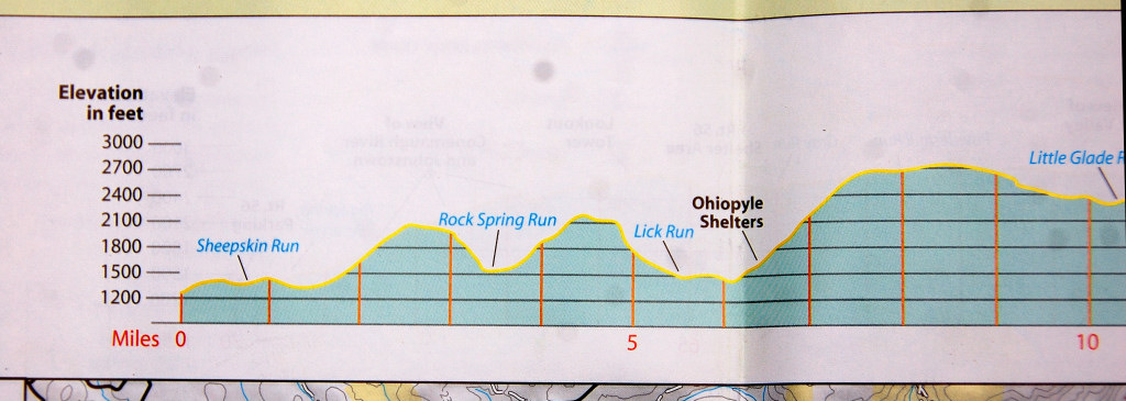
Route Statistics (apprx.)
Length: 4 miles
Elevation: +1400', -1400'
Here's the route:
Start at mile marker 8 on the LHHT. Run down to mile marker 6, turn around, run back up to 8. Done. If run in a proper fashion, you should be fairly close to passing out when you arrive at 8! Repeat as necessary... Negative splits anyone?
Note: If you want to try it with fresh legs, this challenge can be easily accessed by parking on Conn Rd. at the trail crossing (mile 7.4). Directions (map below): Head north on Rt. 381 out of Ohiopyle. Take the first right, Maple Summit Road. In several miles turn right onto Augustine Road (Augustine and Conn are a shared road labeled as Augustine at the hardtop). Augustine quickly becomes a dirt road. Continue back Augustine/Conn Rd. to where it makes a sharp uphill left. You'll see a gate ahead. Turn left just before the gate and park at the pull of on the left. You should be able to see the yellow blazes of the LHHT ahead of you. Follow the trail uphill to get to mile marker 8 and the start.
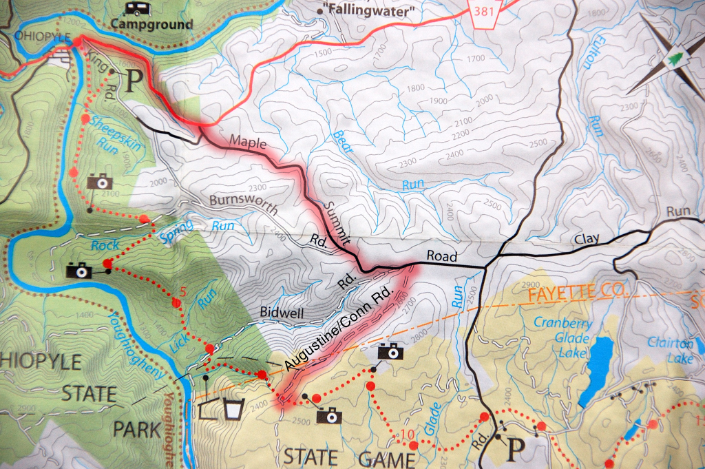 |
| LHHT "Heart Attack Hill" Challenge MP 8-6-8, Map to easy access parking. |
Runners who have completed this challenge (PR only)
July 28, 2013
Tim Anderson - 40:35 (FKT)
No comments:
Post a Comment